Home Overview People Places Industry Clothing & Products Interactives * Contact Us Help
You are in: Places > Cottonopolis > Cheetham Hill Print Page     Email Page  
* * *
Ancoats
Ashton Canal
City Centre
Cheetham Hill
Chorlton on Medlock
Northern Quarter
*
(exists (Dc1Subject_tab where Dc1Subject contains \'Cheetham Hill selection\'))
*
Contact sheet1 to 3 of 3
ImageCreatorTitleDate Created
Image Number: 5000225
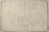
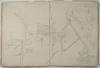
Ordnance SurveyA plan of Manchester and Salford. Bury Old Road to Crumpsall Green. 1850.1850
Image Number: 5000227
Ordnance SurveyA plan of Manchester and Salford. Tetlow Fold to Crescent Road, Cheetham Hill Road. 1850.1850
Image Number: 5000231
Ordnance SurveyA plan of Manchester and Salford. Cheetham Hill Road to Smedley Road, River Irk. 1850.1850
Contact sheet1 to 3 of 3
*
*
Image: Exterior view of Quarry Bank Mill Image: Map showing NW Cotton towns
Image: Railway viaduct Image: Derelict mill, Manchester
Image: Exterior view of Mill at Helmshore Image: Canalscape showing gasometer
New Opportunities Fund - Lottery Funded - logo
8
© Manchester City Council | Terms & conditions